 In August 2013, the Purdue Arboretum launched its new Scan, Link, and Learn educational initiative. This initiative involves an extensive, interactive mobile-learning platform, database, and the geo-location of all woody plants and landscape features, collectively called the Purdue Arboretum Explorer. The original system utilized BG-Base and BG-Map, however in 2023 the Arboretum migrated to ArcGIS and WordPress. An important aspect of Scan, Link, and Learn and the Purdue Arboretum Explorer is the labeling of one or more representatives of each of the 779 unique ornamental woody plant taxa on campus. Users can scan QR codes on a plant or landscape feature label, link to that plant or feature's page on the website, and learn by using the wide expanse of information available on the website and database for all aspects of the arboretum. While there has been some debate as to the place of technology in public gardens and landscapes, the Purdue Arboretum feels that with Scan, Link, and Learn, it is best adapting to and "speaking the language" of its specific and diverse taxa of users at the university.
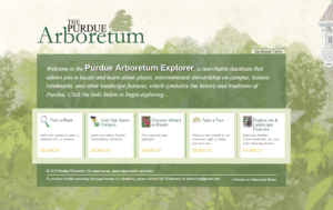
Features of the Purdue Arboretum Explorer
-
- Search for Plants by Name, Characteristic(s), or Location on Campus
-
- Learn More About Purdue's Sustainability Initiatives
-
- Take One of Our Self-Guided Tours Created by Our Staff
-
- Mobile Users can Locate What's Around Them While on Campus